Time to explore the summit of Monte Roraima crossing borders between Venezuela, Guyana and Brazil.
Exploring the summit
[highlight]Leia em Português[/highlight]

Day 4
I woke up early and started organizing for the longest stretch of the expedition, 22 km in the three countries. At least we would come back to the same hotel, so we did not have to strike camp.
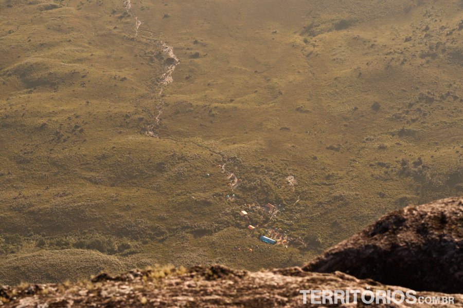
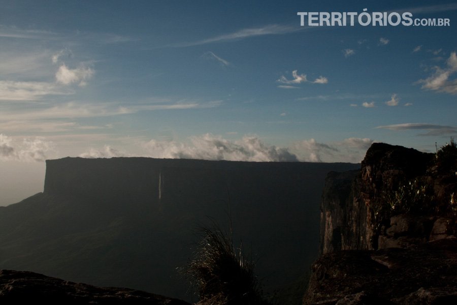
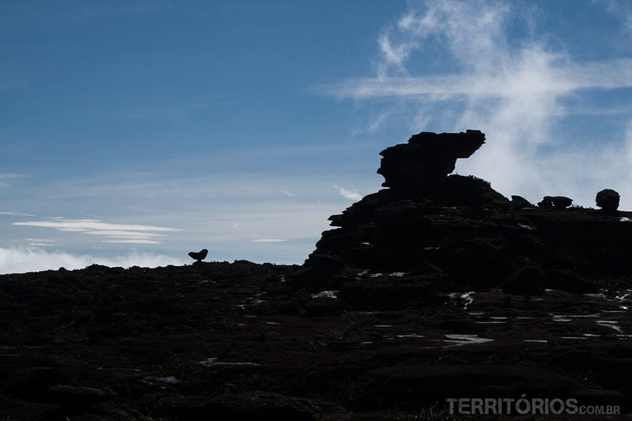
Even with the sun shining bright, the temperature was low and the wind stung – especially enjoying the view of Janela, the closest cliff to our cave. We could see the whole trail from Paraitepuy and the base camp really small down there.
The military tent remained in our last camp; here each group mounts their own bathroom in strategic places. Ours had a spectacular view – Janela on one side and Kukenán on the other, with the full moon in the morning. It was also a window shop for the visitors at Janela, although they do not even notice this detail with the view; for those on the toilet it was complicated to be at ease feeling observed. Luckily it was cold and people did not stay there for long.
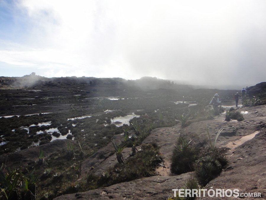

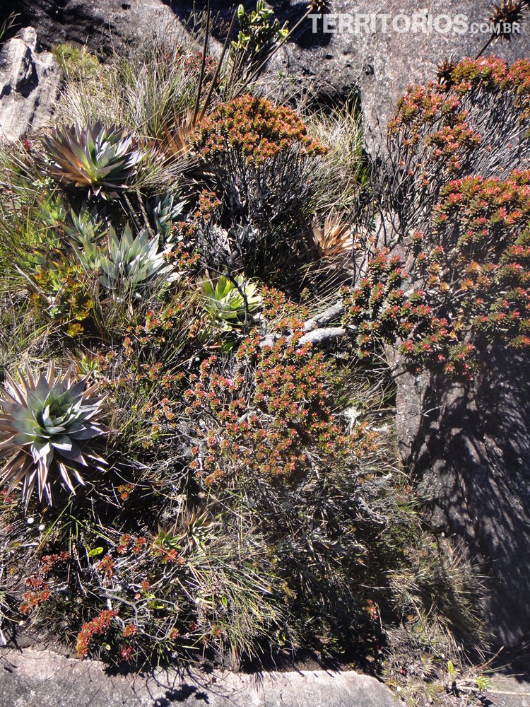
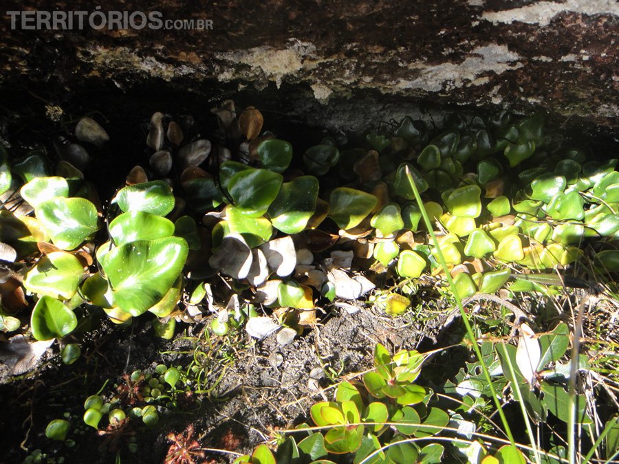
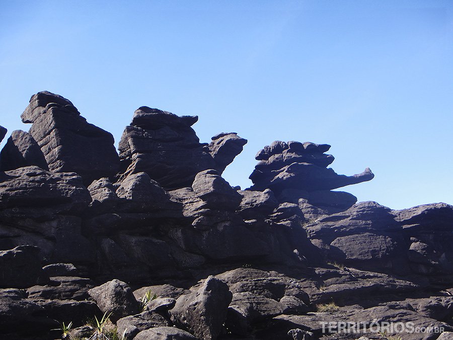
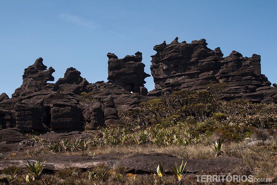
The path is a rock labyrinth, easy to get lost in, especially when the clouds made it difficult to see. In moments like these I walked faster, afraid of being far from the guide – only he knew the way. The ground, which seemed plain, is really bumpy and slippery. The black stones are covered with a kind of slime and the rule is to always walk on the clearer parts, these formed the trail and were not slippery. Among the rocks, we stepped on sand, mud, puddles and gardens. I felt sorry for stepping on those flowers, but it was either that or a sure fall.

We followed on winding paths, climbing rocks and around other valleys. At one point it reminded me of the movie “127 Hours”; I should be extremely careful to pass under huge rocks – if I were fatter I would not be able to pass with the backpack. The tension did not allow anyone to take pictures; we wanted that part to be over as soon as possible.
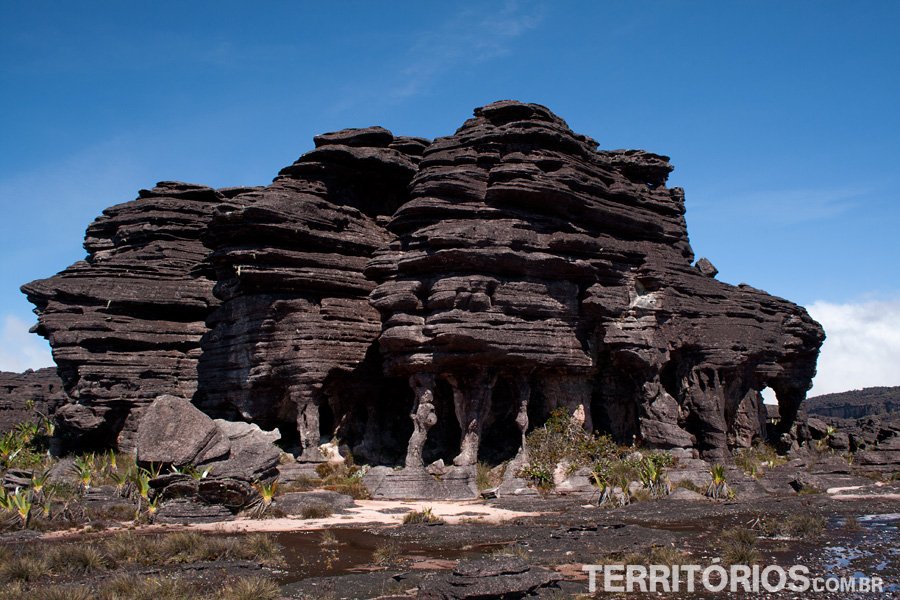
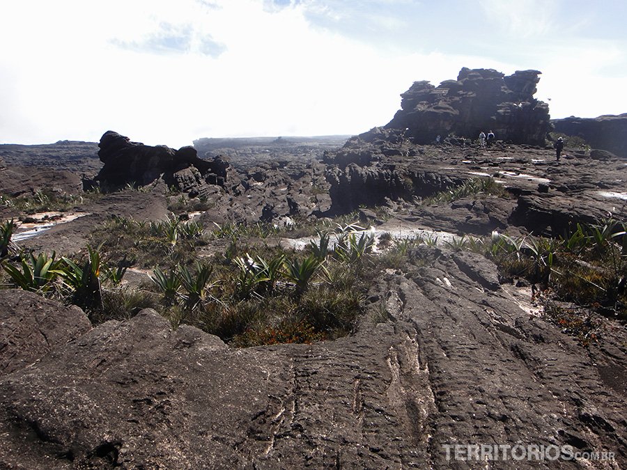
Sucre Valley awoke our imagination with its rock formations and vegetation; then, I was impressed with the beauty of Arabobo Valley. The small portion that belongs to Brazil provided the most beautiful pictures, including Crystals Valley – there the mineral shines on the ground and rock walls.

We reached the Triple Point, limit of the three countries with an obelisk in the middle of nowhere, the highlight of our expedition and where we set foot in Guiana. From there we headed to the camp on other ways.


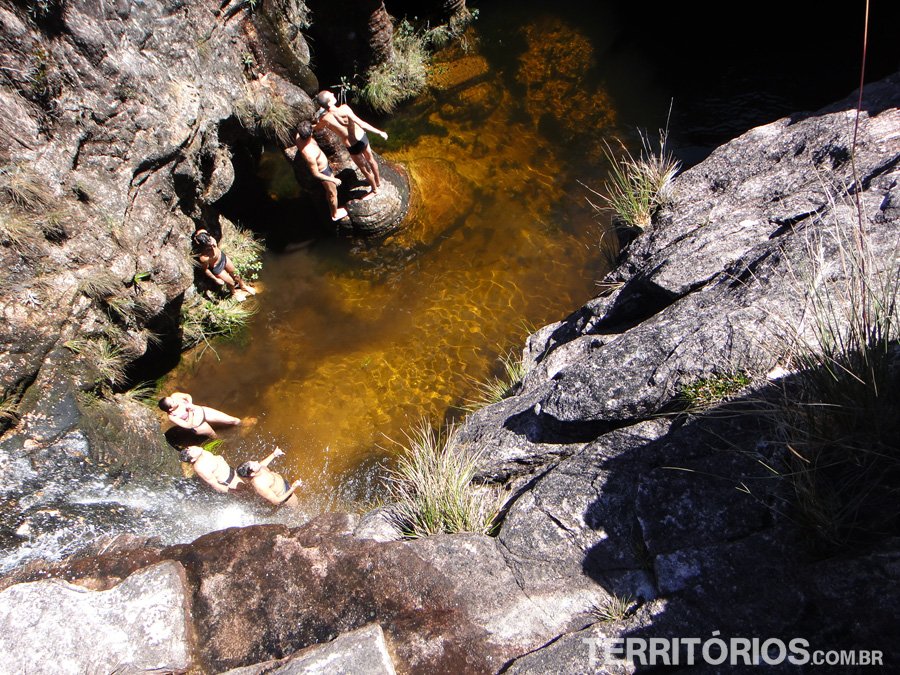
We were tired out when an indian reached us bringing the kitchen (backpacking stove, plates, silverware…) and serving delicious pasta with chicken. Well fed, I looked around and sighed “What a place!” A brook ran to a hole, only by getting closer you could see what there was inside: a great pit hole with a waterfall forming a lit pool and surrounded by unique rock formations. To get down there, the only way is to get into another hole a little farther and follow through underground galleries, wetting the feet in the freezing water. I just enjoyed the view and the courage of the travelers who had the daily bath in El Fosso. See details and more picture in the Week’s Photo #63.
It was still daylight when we got back to the hotel and enjoyed the view of Janela at sunset. Kukenán was different, it displayed a 640-meter waterfall (which was not there in the morning) falling from the summit. People say it is common for waterfalls to be formed according to the rain.
New adventurers arrived and crowded the camping; it was interesting to listen to them talking about the ascent. Clearly each one has their impression, different sensations and a unique relation with the mountain.

There are weird insects up there, some shine in the dark and others are entirely black or have strange legs. There are no snakes, but frogs, centipedes and spiders, among the most recognizable. When almost everybody had gone to sleep, I looked for a place in the woods “to go”, trying to stay near. I turned off the flashlight not to be seen and felt something up my leg. Impossible not to scream and run away with the pants down, but it was an overreaction – it was just a big weird cricket that I removed with my hands. What happens is that in the meantime the guide got scared and came in my direction with the flashlight, I kept screaming to prevent him from coming and seeing me like that. Laughter all around camp and I was so embarrassed and worried for having screamed. The Indians had warned that the mountain does not like screaming, but the guide said it was ok in this situation.

I went to sleep in silence.
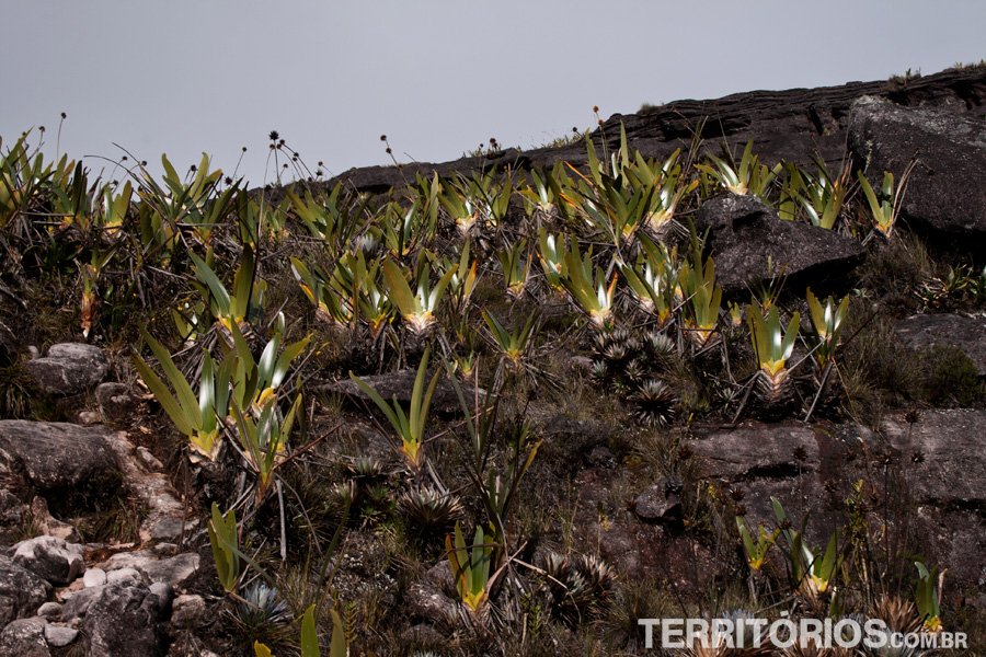
[box]TAKE NOTE
Read Pre-historic gardens post. It is about the flowers on top. [/box]
Day 1 – Day 2 – Day 3 – Day 4 – Day 5 – Day 6 (portuguese)
See more pictures from the fourth day:


© All rights reserved. Pictures and report 100% originals.
Translated by Lúcia Maciel
English teacher